Tracking the sea ice exported from the Siberian Shelf to the Arctic Ocean
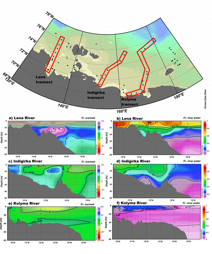
An original method based on the use of the couple salinity – δ18O allows determining the fractions of water that had been removed as ice across the shelf and the consequent net export of sea ice from Laptev and East Siberian Sea towards the remaining Arctic Ocean (860 km3/yr).
An important point is that this method does not assume an ice end-member of fixed composition, very powerful when applied on samples with large differences in salinity….

Figure: The map shows three geographical lines, sections, in the Laptev and East Siberian Sea. The sections stretch from the mouth of the Lena-, Indigirka- and Kolyma rivers and northward onto the shallow shelf. Based on the δ18O in the water, the vertical profiles indicate the amount of river water on the shelf (b, d and f) and also the fraction of water exported from the shelf as ice (a, c and e). Click here to view the figure larger.
Reference:
Rosén, P.-O., Andersson, P. S., Alling, V., Mörth, C.-M., Björk, G., Semiletov, I., & Porcelli, D. (2015). Ice export from the Laptev and East Siberian Sea derived from δ18O values. Journal of Geophysical Research: Oceans, 120. doi:10.1002/2015JC010866
