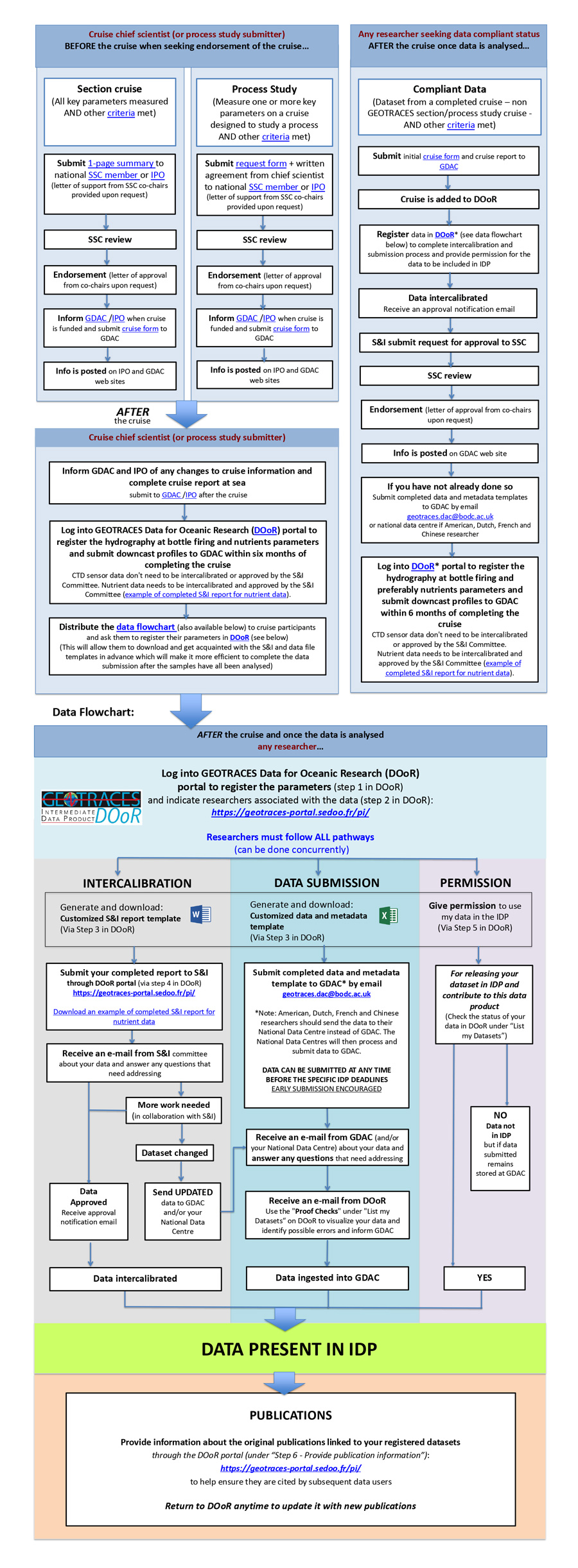
Guide to cruise chief scientists and principal investigators


flow chart (available to download here) is provided to guide:

(1) cruise leaders who wish to develop a research programme to be designated as a GEOTRACES cruise or compliant data,
(2) principal investigators willing for their data to be included in the GEOTRACES Data Products.

As illustrated in the flow chart, there are two parallel pathways – (1) data submission to the appropriate data centre and, (2) the intercalibration process for that dataset via the Standards and Intercalibration Committee. You must follow BOTH pathways, which can be done concurrently, in order to have your data included in the IDP. To help you with these tasks, we have designed a new interface, the GEOTRACES Data for Oceanic Research portal (DOoR) where you register your data sets for intercalibration and potential inclusion in the IDP.

Please note that since IDP2021 GEOTRACES data is released under the IDP Fair Use Agreement to cover appropriate recognition of researchers in the subsequent usage of IDP.

Download the flow chart as a PDF file to have the hyperlinks enabled

 Cruise form – cruise forms – metadata form – post-cruise form – Metadata template 

Rechercher