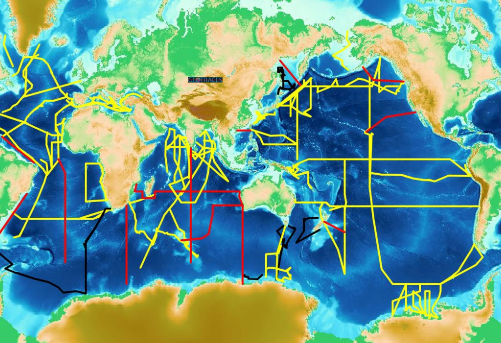
The central focus of the programme is a series of cruises – GEOTRACES Sections – that cover the global ocean to map the distribution of trace elements and isotopes and to access the processes that control this distribution. These GEOTRACES Sections are shown in the map below. GEOTRACES section cruises must follow the “Criteria for establishing GEOTRACES Ocean Section cruises” and be approved by the International GEOTRACES Scientific Steering Committee (SSC).
The programme also endorses a number of studies that focus on particular regions or processes – GEOTRACES Process Studies – and also collates appropriately intercalibrated trace element and isotope data from other cruises as GEOTRACES compliant data. They must follow the “Criteria for establishing GEOTRACES Process Studies” or the “Criteria for Compliant Data” and be approved by the International GEOTRACES SSC.
A flowchart to guide scientists who wish to develop a research programme to be designated as a GEOTRACES cruise or compliant data is available here.
Information about GEOTRACES cruises is maintained by the GEOTRACES International Data Assembly Centre (GDAC) at the British Oceanographic Data Centre (Liverpool, United Kingdom). For cruise information, please click here (you will be transferred to the GDAC web site).
GEOTRACES Cruise Basin Map
An interactive basin map showing all the GEOTRACES section cruises with indication of the completion status is maintained by GDAC and available here.
For more information, please visit the GDAC web site.