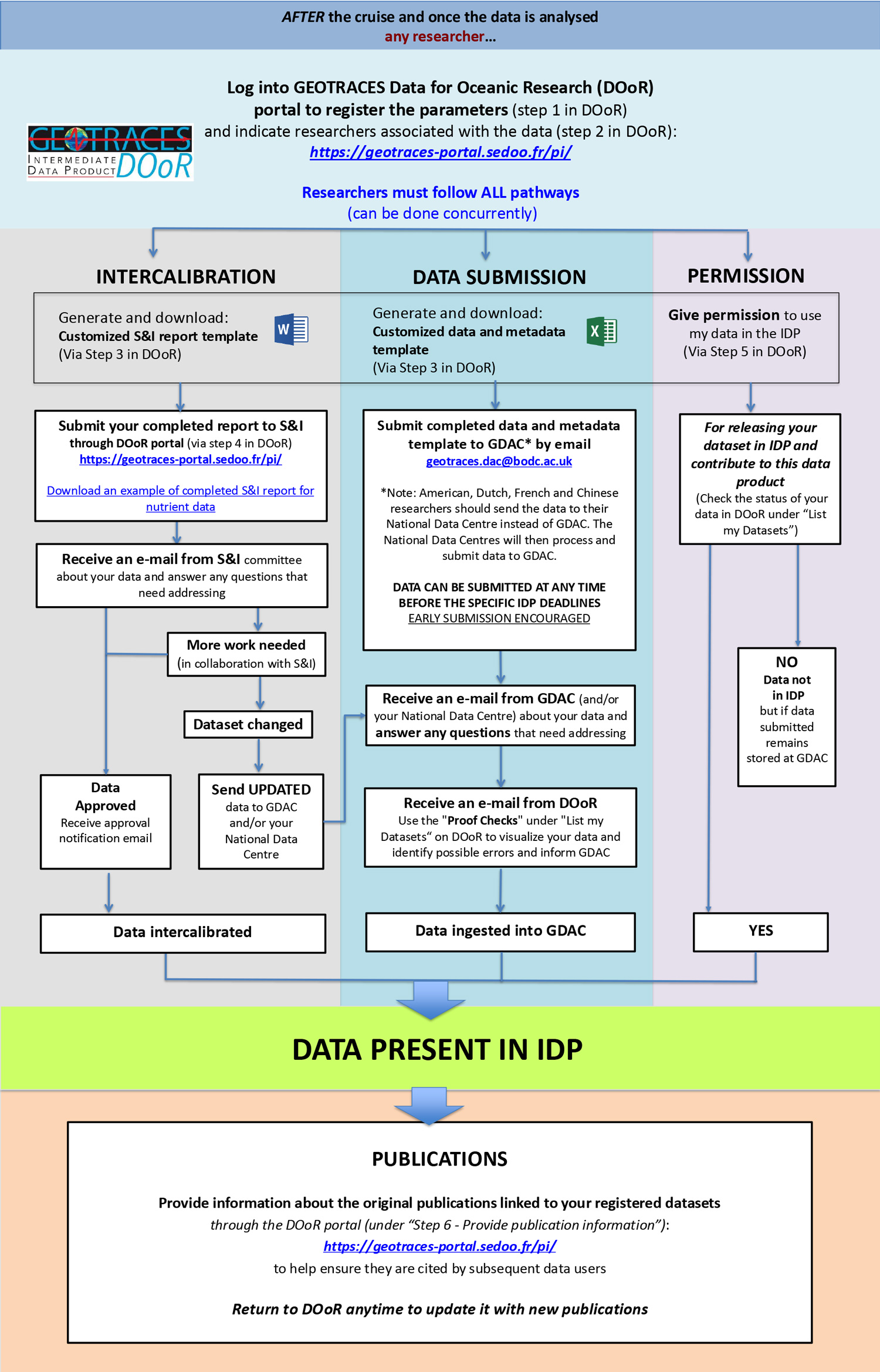
A flow chart describing the steps to follow in order to ensure that your GEOTRACES data are included in the Intermediate Data Product is now available to download and it is also presented below (as image, please download to have active links).
As illustrated in the flow chart, there are three parallel pathways – (1) data submission to the appropriate data centre, (2) the intercalibration process for that dataset via the Standards and Intercalibration Committee and (3) provide permission for the data to be publicly released in the IDP. You must follow ALL three pathways, which can be done concurrently, in order to have your data included in the IDP. To help you with these tasks, we have designed a new interface, the GEOTRACES Data for Oceanic Research portal (DOoR) where you register your data sets for intercalibration and potential inclusion in IDP.
IMPORTANT! A major change with IDP2021 was the move away from the formal registration step towards adherence to a fair use agreement (available here), to cover appropriate recognition of associated researchers in the subsequent usage of IDP.
Download the flow chart as PDF file to have the links enabled