GEOTRACES publishes the motivations and description of its first Intermediate Data Product
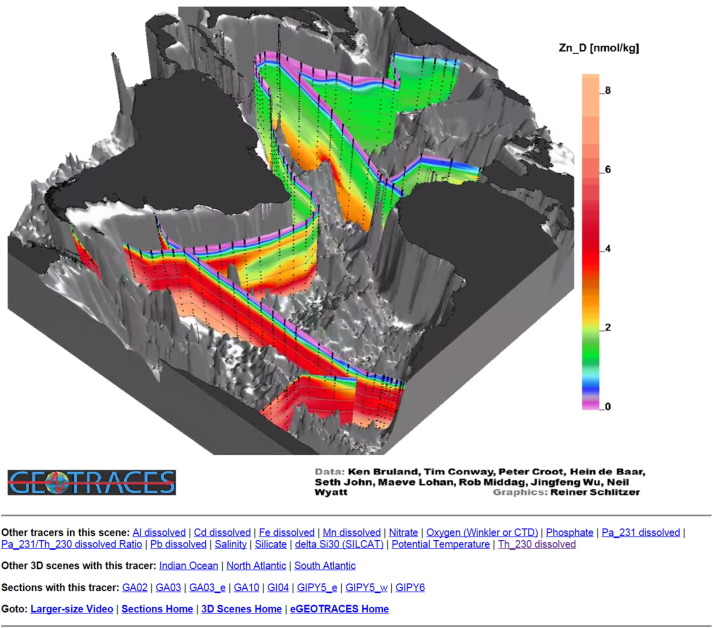
GEOTRACES proposes an article that describes its first integrated and quality controlled Intermediate Data Product 2014 (IDP2014): the digital data package and the eGEOTRACES electronic Atlas that provides section plots and animated 3D scenes of the data. The 3D scenes provide geographical and bathymetric context crucial for tracer assessment and interpretation.
With this release, GEOTRACES seeks to promote intensified collaboration within the marine geochemical community and beyond. The availability of a large integrated and quality controlled dataset, such as the IDP2014, will allow a much wider range of studies than would be possible with individual cruise data alone. Such open access is also an opportunity for other communities as for example physical and biological oceanographers, modellers but also policy makers…

Figure: 3D scene showing the distribution of dissolved zinc (Zn) in the Atlantic Ocean.
Reference:
Mawji, E., Schlitzer, R., Masferrer-Dodas, E., et al. (2015). The GEOTRACES Intermediate Data Product 2014. Marine Chemistry, 177, 1–8. doi:10.1016/j.marchem.2015.04.005
