GEOTRACES: Get the right data!
Measuring concentrations of many constituents at the nano- to picomolar levels in seawater is a difficult challenge, requiring thorough intercalibration between the different laboratories participating to the same programme. GEOTRACES is but one example of a programme that has intercalibration as an essential component of its field-based efforts. The standing GEOTRACES Standards and Intercalibration Committee (S&I) chaired by Greg Cutter was initiated to ensure precision and accuracy throughout the programme’s life. To facilitate consistent sampling and sample handling procedures between cruises and participating laboratories, the S&I Committee in collaboration with the elemental coordinators created a set of written protocols for each suite of trace elements and isotopes. Cutter’s paper emphases on the importance of rigourous intercalibration protocols to get the right data.

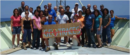
Figure: Participants on the first leg of the 2008 intercalibration cruise in the North Atlantic Ocean abord R/V Knorr
Reference:
Gregory A. Cutter (2013), Intercalibration in chemical oceanography-Getting the right number, Limnology and Oceanography-Methods, Volume: 11, p. 418-424 DOI: 10.4319/lom.2013.11.418
